
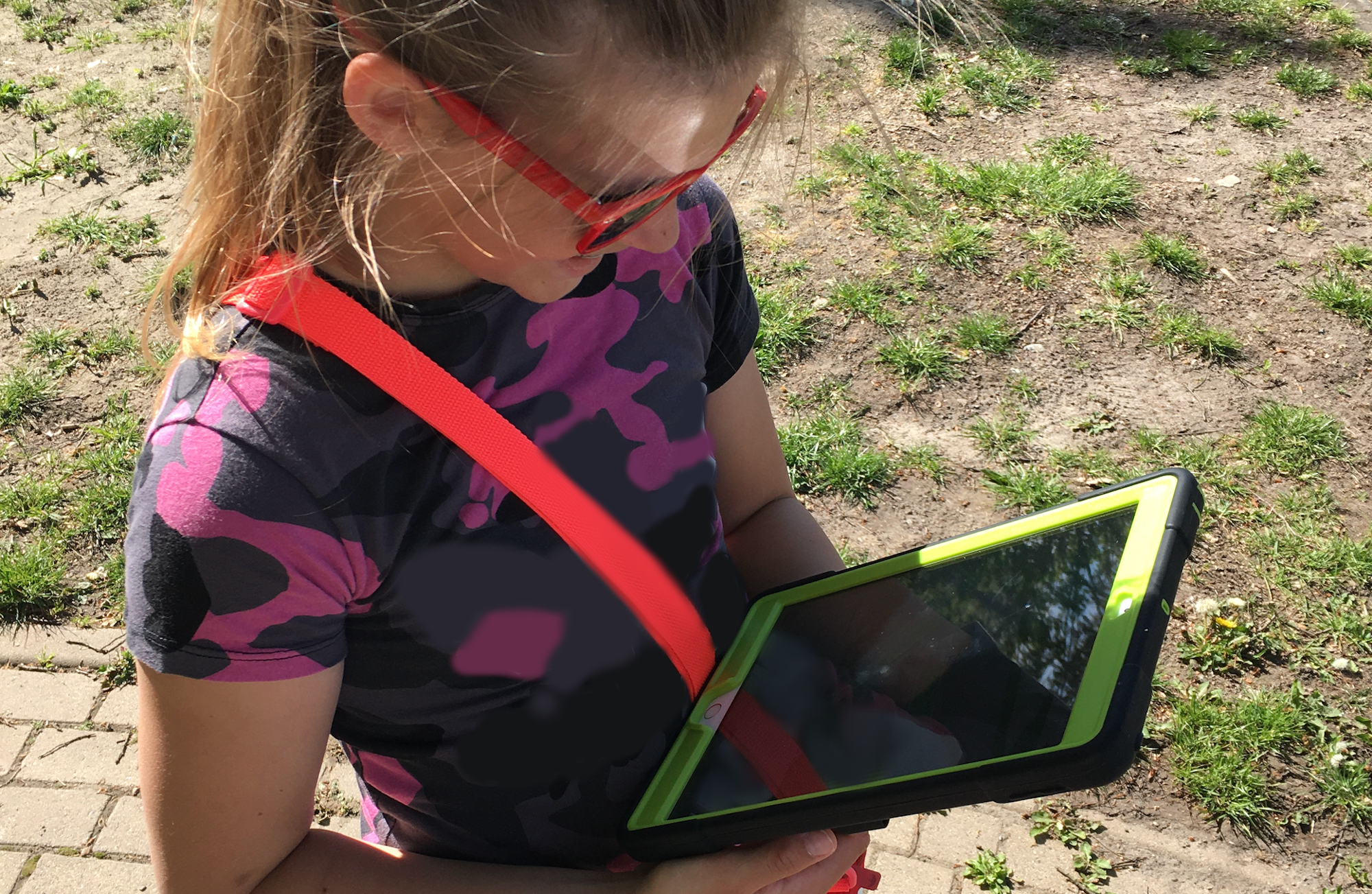
With the help of GeoGami, we take a closer look at measuring and training navigational map reading competencies with primary and lower secondary school children.
We have developed a test instrument with which we can determine
what kind of skills children have orienting and navigating with a map. We implemented the test
for two selected locations and successfully evaluated it in a study. The children that participated in our study
had the task of using GeoGami to solve map reading tasks in a park environment. In doing so, they had to orient
themselves with spatial information such as the arrangement of paths, benches, trash cans and trees, which were displayed on the map.
Our test is designed to be transferable to other locations. Those interested can download our Reproducible Paper
and implement the test for the location of their choice.
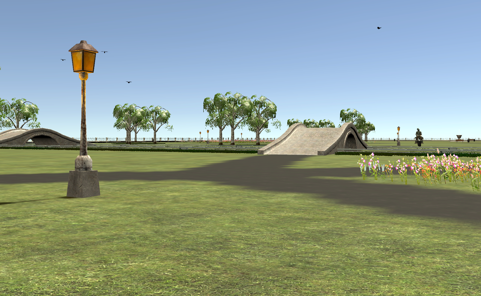
We have also developed the test for virtual space to make it usable regardless of location. The results of the associated study are currently being evaluated by out team.
In the next step, we would like to use GeoGami to develop learning modules that can be used to train children in their map-based orientation. For this purpose, we have equipped GeoGami with a variety of map features to help children learn suitable strategies.
We are currently developing GeoGami into a multi-user learning app. Our goal is to encourage children in their collaborative learning strategies and to explore children's map-based collaboration strategies. More information about the multi-user functionality will follow here soon.
Bistron, J.; Schwering, A. (2021): Measuring Navigational Map Reading
Competencies: A Pilot Study with a location-based GeoGame.
(Preprint)
Bistron, J.; Schwering, A. (2021): Open Reproducible Data of the GeoGami
NMR Assessment for Navigational Map Reading Competencies.
(R Script)
Bistron, J., Schwering, A., Erdmann, F. (2021): GeoGami – An educational
geogame for training navigational map reading – open source implementation.
(App)
Bartoschek, T.; Schwering, A.; Li, R., Münzer, S., Carlos, V. (2018):
“OriGami: A Mobile Geogame for Spatial Literacy”. In:
Ola Ahlqvist and Christoph Schlieder (Eds): Geogames and Geoplay.
Bartoschek T., Schwering A., Li R. (2013): 'Ori-Gami – Fostering Spatial
Competency Development and Learning.’ Poster contributed to the ESRI Education
User Conference, San Diego.
Bartoschek T., Schwering A., Li R., Münzer S. (2013): ‘Ori-Gami – An App
fostering spatial competency development and spatial learning of children.’
Contributed to 16th AGILE Conference on Geographic Information Science, Leuven.
We are happy about interested students from the geoinformatics
and the teacher training programs!
Bluetooth beacons vs. GPS (Master Geoinformatics)
Usability study and video tutorials (Bachelor teaching program)
Analysis of strategies in map-based orientation (Bachelor teaching program)
Semantic analysis of trajectories (Master Geoinformatics)
GeoGami for social space analysis (Bachelor teaching program)
GeoGami as a university excursion app (Bachelor teaching program)
Semantic analysis of trajectories (Master Geoinformatics)
or your own idea!